Subject: Florida
Period: 1839 (dated)
Publication:
Color: Black & White
Size:
28.5 x 39.8 inches
72.4 x 101.1 cm
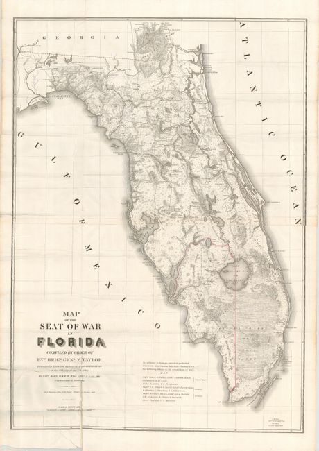
This large, remarkable map of Florida at the time of the 2nd Seminole War was drawn by Capt. John Markey and Lieut. J.E. Blake. There is great detail of Army forts, battlegrounds, Seminole villages, vegetation, hydrology, and a large network of roads and trails; many labeled with the related military action. Crossed swords are used as an icon to locate battles. Hand colored in outline to designate the District assigned to the Seminoles by the Arrangement of Gen. Macomb on May 18, 1839. The panhandle west of Tallahassee and the Ocklockonee River is not included. Two sheets joined and folding, as issued.
References: Claussen & Friis #316; Phillips (M) p. 284; cf. Schwartz & Ehrenberg, plt. 160.
Condition: B
Bright, crisp impression with wide margins. The map folds as issued with some separations (repaired with archival tape), particularly in the lower left quadrant A repaired binding tear enters the map about 1.5".