Catalog Archive
Auction 119, Lot 257

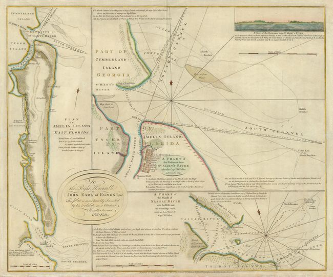
"A Chart of the Entrance into St. Mary's River Taken by Captn. W. Fuller in Nov. 1769 [on sheet with] Plan of Amelia Island in East Florida [and] A Chart of the Mouth of Nassau River …", Jefferys, Thomas

Subject: Florida

Period: 1770 (dated)

Publication:

Color: Hand Color

Size:
24 x 20 inches
61 x 50.8 cm
Download High Resolution Image
(or just click on image to launch the Zoom viewer)

This interesting sheet has three charts containing soundings and navigational information on Amelia Island and the mouths of the Nassau and St. Mary's rivers. The natural deep harbor on the north end of Amelia Island was an important anchorage for all kinds of sailing vessels including smugglers, pirates, and slave ships. The charts were made during the surveys of Captain William Fuller, who dedicated them to John Earl of Egmont. A prospective view of the entrance to St. Mary's River is inset at upper right.

References:

Condition: B

Lightly toned with some minor paper edge damage that has been reinforced with tissue. There is an extraneous horizontal fold in addition to the normal centerfold.

Estimate: $2,100 - $2,400

Sold for: $3,750

Closed on 5/9/2007

Archived