Subject: District of Columbia
Period: 1845 (dated)
Publication: Hand Atlas
Color: Hand Color
Size:
14.4 x 11.7 inches
36.6 x 29.7 cm
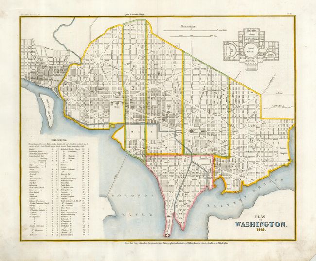
This well engraved and detailed plan is based upon the work of Tanner. While later examples (all dated 1845) list up to 85 important places in the key, this early example contains just 76. At upper right is a large plan of the Capitol Building locating the Senate Chamber, Representatives Hall, the Central Rotunda, Library, West Loggia, and East Portico. The publisher's line beneath the neatline suggests the map was published in Hildburghausen, Amsterdam, Paris, and Philadelphia. A nice example.
References:
Condition: A
A cleaned and pressed example with fine later coloring in outline. The map has a crisp impression and full margins. The tip of the lower right corner is missing and the lower left corner exhibits some creasing, both well away from the image. See image.