Catalog Archive
Auction 119, Lot 246

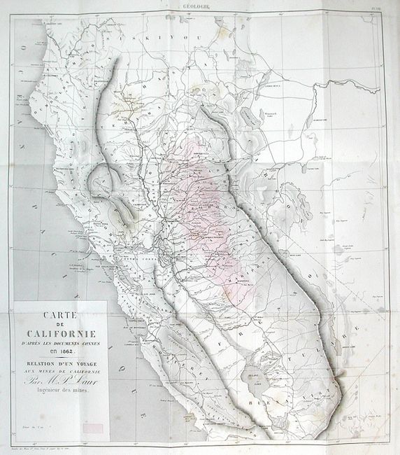
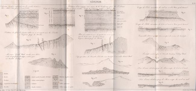
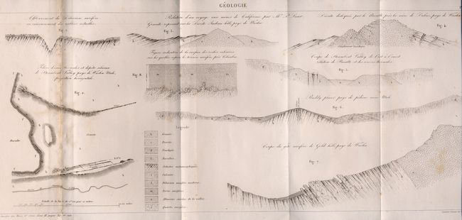
"Carte de Californie d'Apres les Documents Connus en 1862. Relation d'Un Voyage aux Mines de Californie Par M.P. Laur Ingenieur des Mines",

Subject: California

Period: 1862 (dated)

Publication: Annales des Mines ou Recueil…

Color: Black & White

Size:
17.5 x 20 inches
44.5 x 50.8 cm
Download High Resolution Image
(or just click on image to launch the Zoom viewer)

Rarely-seen, first edition of this map by French mining engineer M. P. Laur of the Gold Regions in California. The map shows the state from Crescent City to St Luis Obispo. The Gold Regions are printed in red hachure. The cartography seems to come from a couple different sources, but is based primarily on Fremont's map of the region. Map bound and folded into paper backed report Annales Des Mines ou Recueil, dated 1863, which also includes an early photograph of a miner and three geologic sketches. Not in Wheat or Library of Congress. Octavo, 112 pp plus 4 folding illustrations and 1 folding map.

References:

Condition: B

Paperbacked volume with small loss on covers and scattered foxing throughout book. Some pages are uncut. Map with scattered, light foxing.

Estimate: $550 - $750

Sold for: $425

Closed on 5/9/2007

Archived