Subject: United States - Western
Period: 1856 (published)
Publication: Mitchell's Universal Universal Atlas
Color: Hand Color
Size:
12.5 x 15.6 inches
31.8 x 39.6 cm
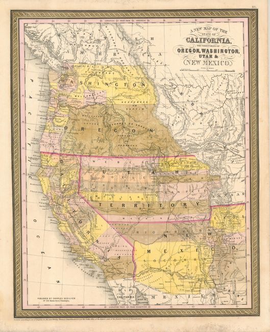
A great map of California and the large western territories from this important series of maps originating from Samuel Augustus Mitchell. The map is filled with early county configurations, the exploration routes of Lewis and Clark, Fremont, Kearney, and Cooke, and the Spanish and Oregon Trails. Washington and Oregon have their eastern boundaries in the Rocky Mountains adjoining Nebraska Territory and county development is confined west of the Cascades. Utah Territory extends to Middle Park and Long's Peak in present-day Colorado where it borders Indian Territory. New Mexico Territory encompasses parts of present-day Colorado and Arizona. The new Gadsden Purchase border is shown and noted Gadsden Treaty Line 1854. County development in California is well underway except in the south. The map retains the Thomas, Cowperthwait & Co. copyright dated 1850 at bottom and is surrounded in their distinctive borders. However, Charles Desilver's imprint has been added above the copyright.
References:
Condition: B
Color is a bit faded, else very good.