Catalog Archive
Auction 119, Lot 215

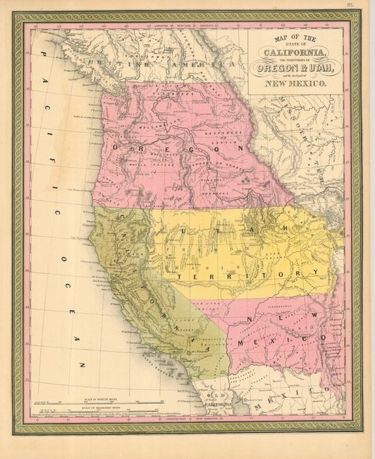
"Map of the State of California, the Territories of Oregon & Utah, and the chief part of New Mexico", Mitchell, Samuel Augustus

Subject: United States - Western

Period: 1850 (published)

Publication: Mitchell's Universal Atlas

Color: Hand Color

Size:
13 x 15.5 inches
33 x 39.4 cm
Download High Resolution Image
(or just click on image to launch the Zoom viewer)

A great map of the western territories and the new state of California from this superb series of maps originated by Samuel A. Mitchell in 1846. Oregon Territory takes in all of present day Washington and Idaho. The huge Utah Territory (formed the previous year) covers the region, labeled Fremont Basin, and stretches from the California border to just past the Rocky Mountains. New Mexico Territory (also formed in 1850) encompasses parts of present-day Colorado and Arizona and its southern boundary is on the Gila River - pre Gadsden Purchase. The Gold Region is clearly marked along the Sacramento River and there is no county development shown in the new state. The copyright at bottom, by H.N. Burroughs, is dated 1845.

References:

Condition: A

Faint toning in Pacific, else fine.

Estimate: $600 - $700

Sold for: $450

Closed on 5/9/2007

Archived