Subject: United States - South Central
Period: 1838 (published)
Publication: Senate Doc 65, 25th Congress, 2nd Session
Color: Black & White
Size:
15.5 x 21.5 inches
39.4 x 54.6 cm
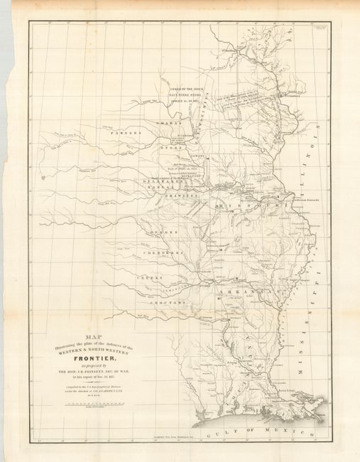
This map was issued as part of the continuing debate over the nature of the Frontier Defenses between the Mississippi River and the Rocky mountains in the Secretary of War, J.R. Poinsett's report of 1837. It illustrates the proximity of the hostile Indian threat that existed in the 1830s and shows the location of Army Posts that were expected to respond to any hostile action. The Military troops at these individual posts were inadequate to counter significant Indian opposition making it necessary for speedy reinforcement. The map includes the states of Missouri, Arkansas and Louisiana and the Indian nations bordering them to the west. Locates many military forts and outposts from Ft. Jessup to Ft. Snelling with notations throughout concerning the regions ceded by several Indian nations with the dates of the treaties. This is one of a group of 3 similar maps published by the 25th Congress, and not be confused with the similar, but less desirable, map published later in American State papers circa 1860.
References: Clausen & Friis #182; Wheat (TMW) #426.
Condition: A
Folding as issued. Very clean and bright with light toning in blank margins.