Subject: Central United States - Wisconsin
Period: 1836 (dated)
Publication: Report of the House Committee on the Public Lands…
Color: Hand Color
Size:
26.5 x 20.5 inches
67.3 x 52.1 cm
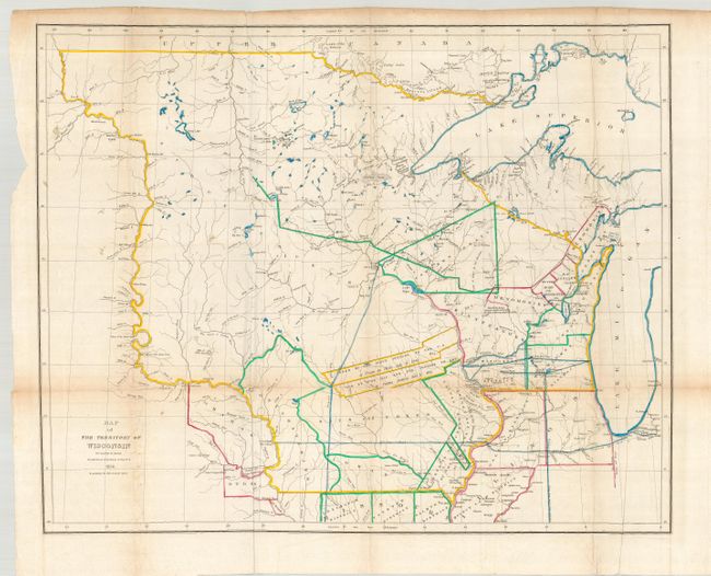
This is a scarce, important and large map of Wisconsin Territory extending to include all of present day Minnesota, the Upper Peninsula of Michigan and most of the Dakotas. The western extent is the Missouri River up to the White Earth River. Outline coloring shows eight districts and numerous land parcels allocated to the various Indian tribes and areas ceded by the Sioux, Sac, and Fox. Filled with detail of forts, ferries, towns and villages including Wisconsin City and Milwaukee. Hydrology is well developed and there is considerable geographic data.
References: Clausen & Friis #145; Karpinsky (MI) #138; Phillips (M) p.1075.
Condition: B
Crisp impression with original outline color. The map folds as issued with faint toning along folds and a couple small intersection separations. There is a binding tear entering the border at left.