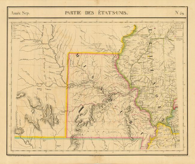
Subject: Central United States - Missouri, Illinois
Period: 1827 (published)
Publication: Atlas Universel
Color: Hand Color
Size:
23 x 19 inches
58.4 x 48.3 cm
This interesting map provides an excellent view of Missouri and Illinois with very early county development. The map is centered on the Missouri River, extending to the Platte and Omaha regions. There is excellent information on Indian Tribes and village populations, mineral deposits, explorers routes, etc. The Atlas Universel was a monumental work and milestone in cartography; particularly the cartography of the American West. It was the first atlas of the world with all maps on the same scale (1: 1,641,836 - about one inch to 26 miles) and the first lithographed world atlas. The maps (400 in all) were intended to be joined together, thus forming a globe measuring 7.75 meters in diameter. There was only one edition, published in a series of parts between 1825-27, and the subscription list shows that only 810 copies were sold.
References:
Condition: B
Fine impression and original outline color printed on sturdy paper with light offsetting.