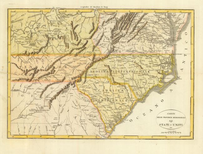
Subject: United States - Southeast
Period: 1800 (circa)
Publication:
Color: Hand Color
Size:
19 x 13.2 inches
48.3 x 33.5 cm
This is a very uncommon Italian map of the southeastern region. The map covers the states of Kentucky, Virginia, Tennessee, North and South Carolina and part of Georgia. It provides a nice view of early settlements and roads, as well as the mountains, forests and Indian villages. Between Tennessee and Georgia is a long strip of land labeled Territorio degli Stati Uniti. This land originally belonged to South Carolina but was ceded back to the United States in 1787, subject to Indian occupancy. Numerous Indian villages are shown, especially in the region of present-day Alabama. This map is from either an Italian edition of Francois la Rochefouchauld Liancourt's Travels through the United States of North America… or Carlo Botta's Storia della Guerra dell' Independenza Degli Stati Uniti d'America. Howes does not list an Italian edition of La Rochefouchauld Liancourt's book, but this map is a copy of his map.
References: cf Howes #106.
Condition: A
Issued folding, now backed with Japanese tissue to reinforce some marginal repairs.