Catalog Archive
Auction 119, Lot 196

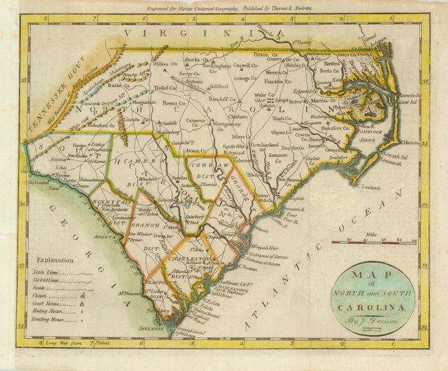
"Map of North and South Carolina By J. Denison", Morse, Jedidiah (Rev.)

Subject: United States - Southeast

Period: 1796 (published)

Publication: American Universel Geography

Color: Hand Color

Size:
9.3 x 7.5 inches
23.6 x 19.1 cm
Download High Resolution Image
(or just click on image to launch the Zoom viewer)

This interesting little map of the Carolinas shows South Carolina divided into districts. In North Carolina numerous counties are named (with many misspellings), but their boundaries are not delineated. Details include roads, churches, and court, meeting and dwelling houses. There are also several Indian villages located. The map was drawn by Denison, engraved by Doolittle, and published by Thomas & Andrews for Morse's Universal Geography.

References: Wheat & Brun #585.

Condition: B

There is a small area of paper weakness that has been reinforced on verso with light Japanese tissue and it has been remargined on binding side (left).

Estimate: $375 - $450

Sold for: $350

Closed on 5/9/2007

Archived