Catalog Archive
Auction 119, Lot 180

"Post Route Map of the States of Massachusetts, Rhode Island & Connecticut", U.S. Government

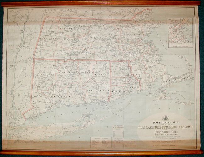
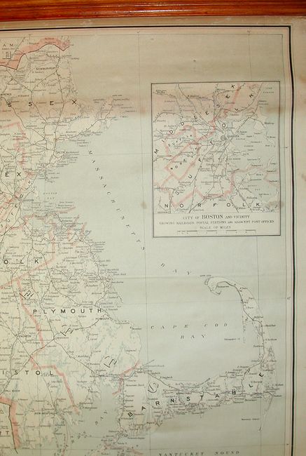
Subject: United States - New England

Period: 1911 (dated)

Publication:

Color: Printed Color

Size:
44.5 x 33.5 inches
113 x 85.1 cm
Download High Resolution Image
(or just click on image to launch the Zoom viewer)

Fascinating wall map showing the postal routes in this region during the beginning of the 20th century. The map is filled with detail of the roads and railroads, and at the bottom are tables for the counties in Connecticut, Massachusetts and Rhode Island as well as a separate table that lists a key for postal routes and mail service frequency, in addition to the location of post offices, both current and discontinued.

References:

Condition: B

The map has some toning across the top and bottom from the wood rollers as well as a few spots in the map. Still good for a map of this type.

Estimate: $150 - $100

Sold for: $110

Closed on 5/9/2007

Archived