Catalog Archive
Auction 119, Lot 159

"New Military Map of the United States Showing the Forts, Military Posts, &c with Enlarged Plans of Southern Harbors", Johnson & Ward

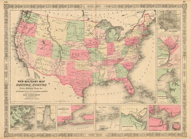
Subject: United States

Period: 1864 (circa)

Publication: Illustrated Family Atlas of the World

Color: Hand Color

Size:
22.5 x 15.8 inches
57.2 x 40.1 cm
Download High Resolution Image
(or just click on image to launch the Zoom viewer)

This is the more desirable issue of this Civil War period map, showing the state and territory borders instead of the Military Districts. It locates forts, camps and military posts throughout. This map shows the transitional western territories as they were during 1864, with an early configuration of Arizona Territory, a huge Idaho Territory, and only one Dakota. West Virginia is shown just after its 1863 division from Virginia. Nine insets of southern harbor towns are arranged to the right and bottom: Baltimore, Washington, Norfolk, Charleston, Savannah, Key West, Pensacola, Mobile and New Orleans. The map retains the 1861 copyright date below the title.

References:

Condition: B

A few spots of foxing and toning as is typical for these maps.

Estimate: $140 - $180

Sold for: $200

Closed on 5/9/2007

Archived