Subject: United States
Period: 1858-63 (circa)
Publication: Weekly Dispatch Atlas
Color: Hand Color
Size:
12 x 16.8 inches
30.5 x 42.7 cm
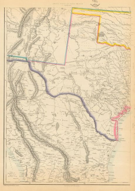
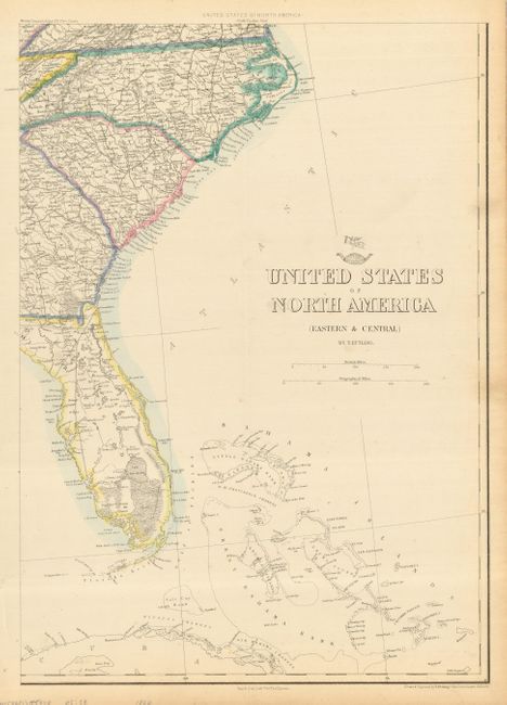
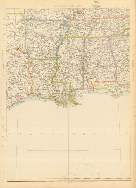
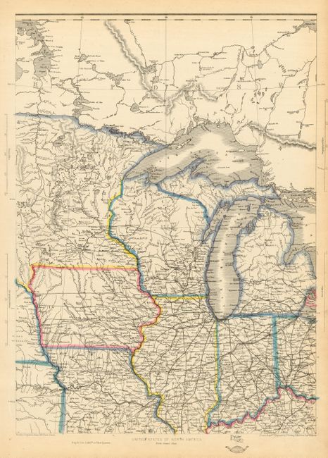
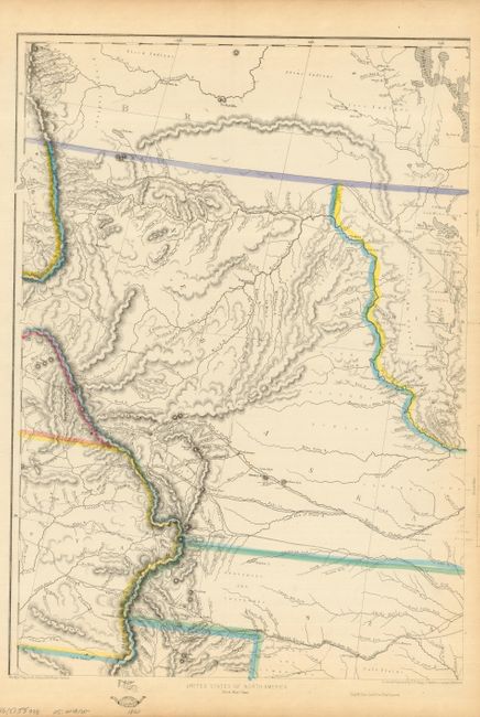
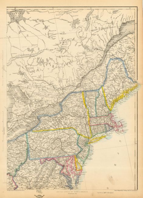
Fascinating, complete set of six maps showing the westward growth of the emerging states and territories just before and during the Civil War. The maps cover the region from the eastern seaboard to Texas and the Rocky Mountains. The size noted is for each map and each has the Dispatch Atlas seal in margin. The sheets are as follows:
1) South West Sheet is focused on Texas and the upper part of Mexico, with a portion of Indian Territory and New Mexico Territory as well.
2) Eastern & Central Sheet shows the Carolinas, a portion of Georgia and most of Florida with some of the Caribbean islands noted.
3) South Central Sheet describes the area from the Gulf Coast to Arkansas and Tennessee.
4) North Central Sheet is focused on the Midwest region including Michigan, Wisconsin, Illinois, Ohio, Iowa and a portion of Missouri and Minnesota.
5) North West Sheet is the most interesting sheet of this map. It shows the large Nebraska Territory extending from Kanzas to the Canadian border, with parts of the adjacent territories, including large Utah and Minnesota territories. Three routes explored for the Pacific Railroads, as well as other expedition routes are shown. Numerous forts and Indian tribes are located.
6) North Eastern Sheet depicts the eastern portion of the U.S. from Maine to Virginia, and including the St. Lawrence River and a portion of Canada.
The Weekly Dispatch Atlas was published in monthly segments for subscribers of the Weekly Dispatch newspaper. The monthly edtions eventually grew to include maps covering most of the known world. Published in various editions from 1855 through the early 1880s.
References:
Condition: A
All maps with original outline color and some marginal toning and a couple soft creases. Map 4 has a short tear just into the map at the upper right, repaired on the verso with archival tape.