Subject: United States
Period: 1855-57 (published)
Publication: Smith's Geography for Schools
Color: Hand Color
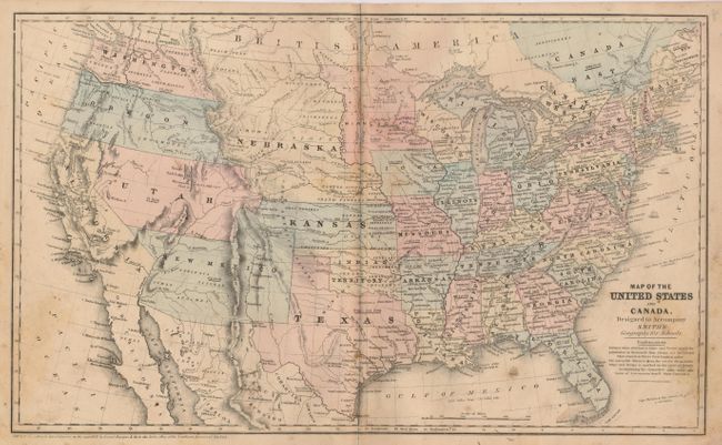
1) Map of the United States and Canada, Designed to Accompany Smith's Geography for Schools, 1855, 17.5" x 10.5". This great school atlas map uses full original hand coloring to delineate the early territorial borders in the West. The territories of Washington and Oregon extend to the Continental Divide, Utah is a huge area that extends to west California and east to the newly formed Kansas and Nebraska. New Mexico Territory occupies all of today's Arizona and part of Colorado. The huge Nebraska Territory stretches between the Continental Divide and Minnesota, and to Canada in the north, and south to Kansas. Minnesota Territory extends to the Missouri River. A large Gold Region is shown in north central California. Each state/territory is labeled with their population. Published for Smith by Daniel Burgess.
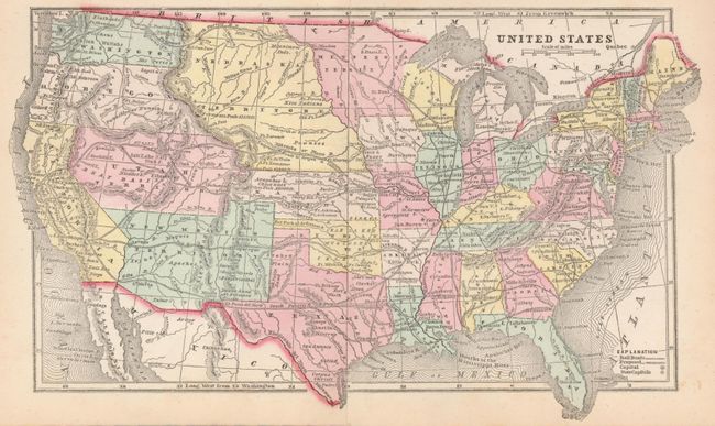
2) United States This is a fine cerographic map from Morse & Gaston's Diamond Atlas, 1857, 11" x 6.5". It features identical boundaries as described above. It further details the country's railroads including those proposed for the West. Printed on two joined sheets, as issued. A lovely example of this fine smaller map.
References:
Condition:
1) It is good with scattered foxing principally in the lower half. 2) Fine.