Subject: World
Period: 1650 (circa)
Publication:
Color: Black & White
Size:
13.8 x 9.8 inches
35.1 x 24.9 cm
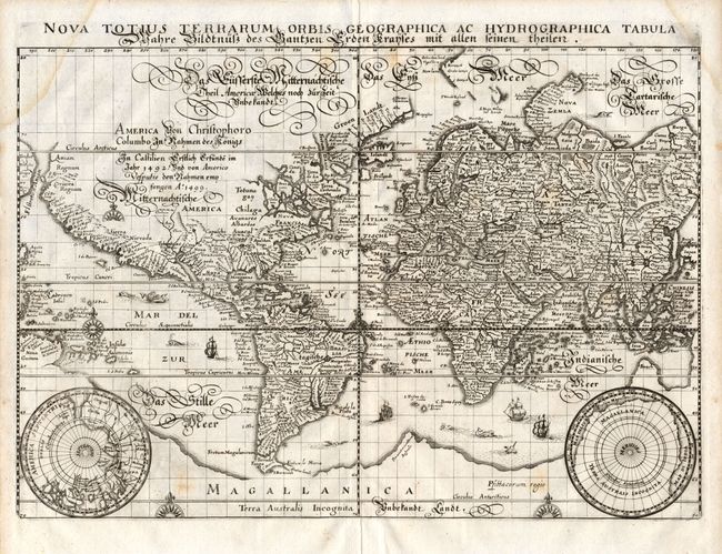
This beautifully engraved world map is presented on Mercator's projection with cartography closely copied from Blaeu's world map of 1606. The Latin title is printed at top, outside the neatline, with a German gothic script title and notation concerning Christopher Columbus' (1492) and Amerigo Vespucci's (1499) discovery and exploration of the Americas, covering the unknown interior of North America. There is a large southern continent connected to New Guinea, California is a peninsula, and there are plenty of open ended waterways in the eastern part of North America, leaving open the question of a Northwest Passage. Two polar projections in lower corners partially obscure the great southern landmass of Magallanica. The landmass is populated by only a few place names, including the regions of Beach and Psittacorum regio (Kingdom of the Parrots) from the travels of Marco Polo. The map is finely decorated with sea monsters, galleons and compass roses. Second state without Merian's signature in the lower right.
References: Shirley #345.
Condition: B
The map has a very nice impression with minor damp stains in the upper corners, just entering the map, as well as a few spots of light foxing.