Subject: Colonial North America, Caribbean
Period: 1783 (dated)
Publication: Atlas Geographique et Universel
Color: Hand Color
Size:
25.5 x 18.8 inches
64.8 x 47.8 cm
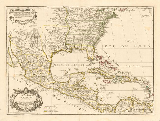
This is a very early map to name the United States, as 1783 is the earliest it appears on any map. This is the last issue of Delisle's map that covers most of the current United States, Mexico, Central America and the West Indies. Considered a foundation map, the first edtiion was the first printed map to correctly show the course of the Mississippi, accurately place the Great Lakes and locate many English coastal settlements. Its longevity and numerous copies by other mapmakers attest to its importance. Dezauche was Buache's son-in-law and the successor to the Delisle business. Dezauche has here altered the original title to include the words "Etats Unis." He also added a legend and color-code to show the colonial possessions of England, France, Spain and the extent of the United States. The bold, strong engraving provides good detail of cities, watersheds, and is decorated with title and scale of miles cartouches.
References: Tooley, (Amer) p.22 #53; cf Cumming (SE) #137; Martin (TX) p.92-3.
Condition: B
Original outline color with a couple of faint stains in ocean, else very good.