Subject: North America
Period: 1840 (circa)
Publication:
Color:
Size:
8.5 x 10.6 inches
21.6 x 26.9 cm
1) Amerique Septentrionale en 1840 Dressee sous la Direction, 1840, Antoine Philippe Houze, Atlas Historique et Géographique… (8.5" x 10.6"). Well engraved map showing North America with an extensive color key referring to historical events in American history. An Independent Texas is outlined in Mexico.
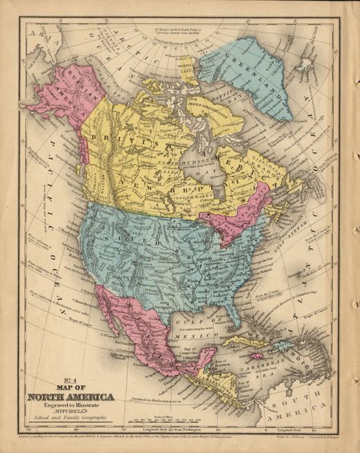
2) No. 4 Map of North America Engraved to Illustrate Mitchell's School and Family Geography, 1858, Samuel Mitchell (8.3" x 10.7"). Alaska is Russian America, Canada is depicted as Canada West, Canada East and British Possessions. The states within the U.S. and Mexico are not delineated. Numerous Indian tribes located throughout. Gold Regions noted in Colorado and California.
References:
Condition: B
Both are near very good. The first has a short tear at binding trim just into border, closed on verso. The Mitchell map is very good with no flaws. It appears the color has been refreshed.