Subject: North America
Period: 1835 (circa)
Publication:
Color: Hand Color
The United States and Great Britain established in 1818 joint claim over the Oregon Territory - the region north of Spanish controlled Upper California up to the southern boundary of Russia's Alaska Territory at North latitude 54°40'. By the late 1830's this arrangement was beginning to fall apart.
In the 1840's the expansionist Democrats, including their 1844 presidential candidate, James Polk, claimed the entire region for the United States. Their expansionist desires were expressed by Polk's famous campaign slogan, "Fifty-four Forty or Fight!" The slogan also became a rally cry for Americans desiring to settle the territory. Following Polk's election, the dispute was resolved by the 1846 Treaty of Oregon, which struck a compromise that fixed the U.S./Canadian boundary at 49º North.
Interesting pair of European maps of North America published during the controversy between Britian and the United States concerning the boundary in the Pacific Northwest .
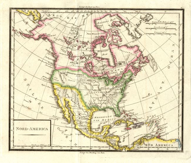
1) Nord-America is an unusual, small map by J. N. Champion depicting the British view of the Pacific Northwest with a meandering boundary dipping down to the Columbia River. The border between the United States and Mexico shows Texas to be a part of Neu Mexico. (9.8 x 8.1")
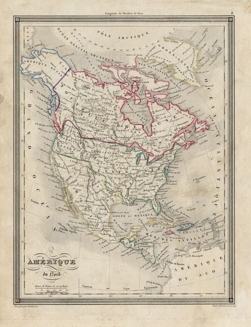
2) Amerique du Nord is a beautifully detailed map by Vuillemin showing Oregon territorial claims extending up into Canada to North latitude 54°40', with Texas shown as part of Mexico. The map is enclosed in a frame-style border. (7.75 x 10")
References:
Condition: A
Map 2 with some light soil, otherwise both are fine.