Subject: Atlases
Period: 1829 (published)
Publication:
Color: Hand Color
Size:
9.3 x 11.7 inches
23.6 x 29.7 cm
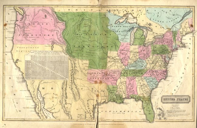
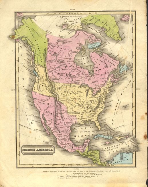
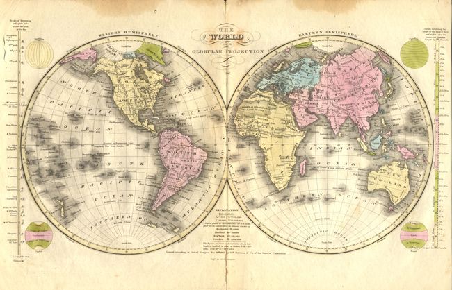
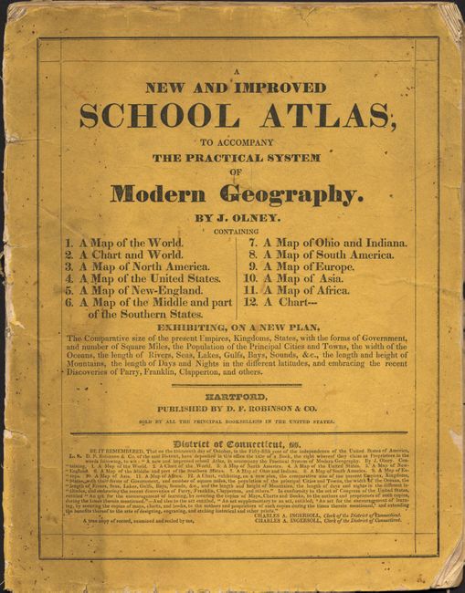
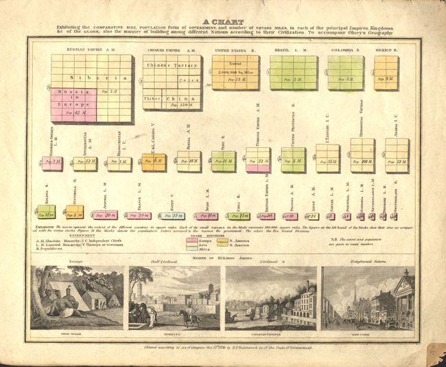
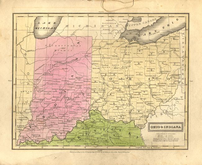
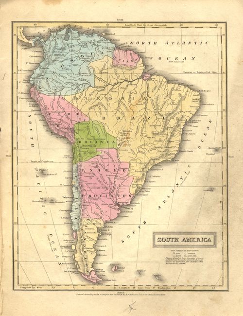
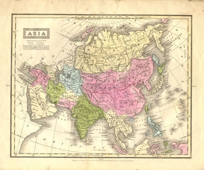
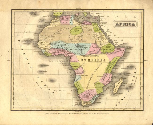
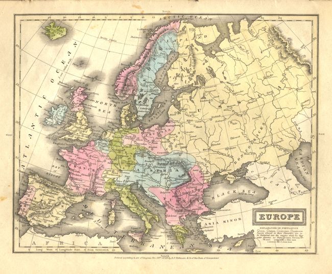
This is a complete example of Olneys' atlas with eleven well engraved and hand colored maps. This early edtion inlcudes these maps: world in hemispheres (dp), world with thematic chart of religions, North America, United States, Eastern States, Middle States and part of Southern States, Ohio and Indiana, South America, Europe, Asia, and Africa. The cartography in the United States shows Wisconsin Territory between Lake Michigan and the Missouri River. The large Missouri Territory extends from the Missouri River to Oregon Territory and south to include Indian Territory. The area of today's Oklahoma is part of Arkansas Territory. On the North American and United States maps the boundary in the Northwest extends well into British America per the "Boundary determined in 1824." A thematic chart shows the comparative size, population and forms of government with four engraved vignettes; Indian Village, Morocco, Constantinople and New York. Printed paper covers that double as the title page and list of maps. Published by D.F. Robinson & Co.
References:
Condition: B
The spine is worn to the point the atlas is disbound. A little marginal staining at top. Maps generally very good to good. The US map has long clean split along lower centerfold and some spots in Texas. A nice example that will be better when restitched.