Subject: North Pacific Ocean
Period: 1784 (published)
Publication: Voyage to the Pacific Ocean…
Color: Black & White
Size:
26.5 x 15.5 inches
67.3 x 39.4 cm
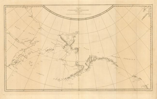
This is the scarce first edition of this map charting Cook's third voyage up the northern reach of the Pacific in his search for a Northwest Passage. Cook probed up along the Oregon coast in bad weather to Nootka Sound, where he rested and refitted his ships. They sailed forth to the Alaskan and Chukotskiy peninsulas and from there into the Bering Strait. Cook got as far north as 70° by 41° N before being forced back by the ice off Icy Cape. The expedition came south down the Russian coast and then east to Norton Sound. Cook's expedition then sailed south to Hawaii, where Cook was killed in a dispute with the natives. His second-in-command Clerke took over the expedition and they explored further in Hawaii before returning north to continue the exploration for the Northwest Passage. Engraved by T. Harmar.
References: Kershaw #1140.
Condition: A
Fine, sharp impression with folds as issued. Some uneven toning in map and a few short tears confined to the blank margin. Hinge remnants on verso.