Subject: North Pacific Ocean
Period: 1782 (circa)
Publication: Prevost's Histoire Generale des Voyages
Color: Hand Color
Size:
14.5 x 10 inches
36.8 x 25.4 cm
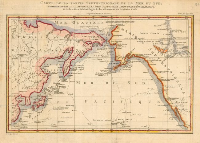
A fine map based on the Henry Roberts/Cook chart with the addition of China, Japan, and the Sandwich Islands. It details the adjacent coastal areas of Russian Asia from the Bering Strait and the Kamchatka Peninsula down to Japan, Korea, and China, and across to the west coast of North America down to below the Baja Peninsula. The interior of the Northwest is completely blank, but details are beginning to emerge along the coastal areas as the maps names "R. De Cook", "Port De Norton", the "B. De Bristol", "Ounalachka," and more. Shows the tracks of Capt. Cook's ships, the Resolution and the Discovery during Cook's third voyage to the Pacific between 1778 and 1789. Cook traveled from the Sandwich Islands to Nootka and the southern coast of Alaska, where he surveyed Prince William Sound and the Aleutian Islands. He then continued northward through the Bering Strait to the Arctic above the 70th parallel before weather and ice forced his return to the Sandwich Islands. The map features lakes, rivers, mountains and other geographical features. Finely engraved by Dupuis. Height given includes the title above neatline. An uncommon Cook map.
References:
Condition: B
On thick paper with large watermark. Very crisp impression which has led to some light offsetting in blank areas, else very good.