Subject: North and Central Asia
Period: 1700 (circa)
Publication:
Color: Hand Color
Size:
23.3 x 19.8 inches
59.2 x 50.3 cm
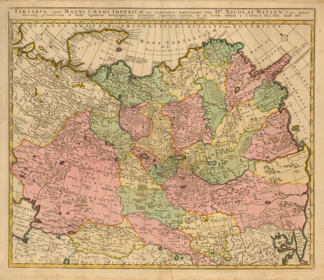
This superb map presents an astonishing amount of detail including roads, towns, rivers, lakes, mountains, forests, swamps and even the known encampments of the nomadic tribes of Central Asia. It covers the region from the Caspian Sea to Korea. The southeastern coast of Nova Zemla is not yet mapped. The major emphasis of the map, as noted in the title, is the illustration of the recent discoveries in the Asiatic region by Nicolas Witsen, a prominent politician, friend of Peter the Great, and maker of a map of Siberia. Witsen's icy cape Scopuli is shown stretching out into the Arctic Sea. This cape was believed to render it impossible to sail round the north-eastern tip of Asia.
References:
Condition: B
Sharp impression and original color. Damp stains in bottom margin, just entering map at bottom centerfold.