Catalog Archive
Auction 118, Lot 799

"La Judee on Terre Sainte, divisee en ses douze Tribus", Robert de Vaugondy, Gilles
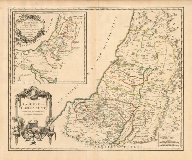
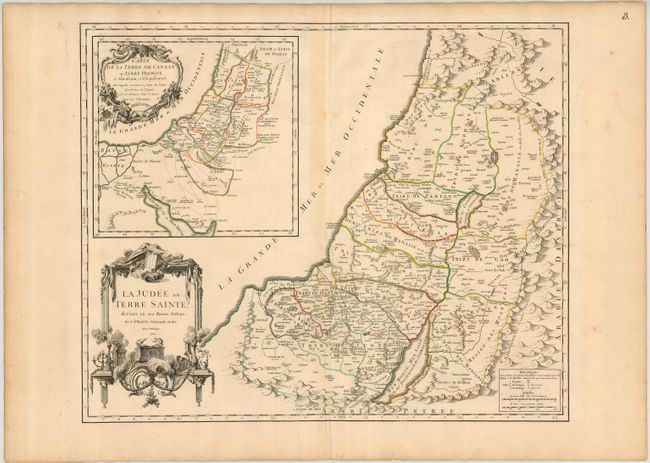
Subject: Holy Land

Period: 1750 (dated)

Publication: Atlas Universel

Color: Hand Color

Size:
23.5 x 19 inches
59.7 x 48.3 cm
Download High Resolution Image
(or just click on image to launch the Zoom viewer)

Lovely, large map of the Holy Land showing the Tribes of Israel. Inset with a large map of the region showing the Exodus and the wanderings of the Children of Israel from Egypt titled Carte de la Terre de Canaan ou Terre Promise… The map is filled with fine detail and ornamented with two elaborate cartouches; the main title cartouche is decorated with an altar, the Ark of the Covenant, and the tablets of the Ten Commandments.

References: Laor #667; Pedley #393.

Condition: A

Nice, dark impression and original outline color. Couple of wormtracks in large, generous margins, not affecting map.

Estimate: $350 - $400

Sold for: $250

Closed on 3/6/2007

Archived