Subject: Holy Land
Period: 1628 (published)
Publication: Atlas Sive Cosmographicae
Color: Hand Color
Size:
19.5 x 14 inches
49.5 x 35.6 cm
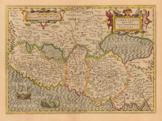
Lovely map of the Holy Land oriented with east at the top. The land is shown divided into theTwelve Tribes and is centered on Samaria. This map is based on Ortelius' map of the region from 1570, which in turn was based on Peter Laicksteen's wall map describing his 1566 visit to the Holy Land. The Dead Sea has four cities shown burning within it: Sodoma, Gomorra, Adama and Seboim. The Mediterranean Sea is enlivened with a depiction of Jonah being cast out of the ship and into the waiting jaws of the whale. The map is adorned with two strapwork cartouches. French text on verso.
References: Laor #494.
Condition: B
Evenly toned throughout map with delicate original color in the Mercator/Hondius distinctive palette. Short tears in the bottom blank margin, not affecting map. Some light abrasion at centerfold and a couple tiny spots of foxing.