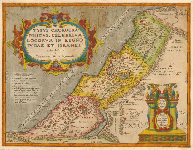
Subject: Holy Land
Period: 1586 (dated)
Publication: Theatrum Orbis Terrarum
Color: Hand Color
Size:
18 x 14 inches
45.7 x 35.6 cm
This is a superb map of the ancient kingdoms of Judea and Israel based on Tilleman Stella's maps of 1552 and 1557. The coastline extends from Beirut, here named Berytus in the north to El-Arish, named Rhinocorura in the south. This is a fine example of Ortelius' engraving style ornamented with two extraordinary strapwork and figural cartouches. A key identifies major cities, priestly and sanctuary towns, Philistine cities, and places belonging to the tribes of Ephraim and Simeon. The map is dated 1586 but was not published until 1590. This example was included in the 1602 edition. German text on verso.
References: Tooley (TMC-3, pp.28-31); Van den Broecke #180.
Condition: B
Paper reinforcements on verso and also along margins on recto. Some mildew at the top of the map. Still a beautiful piece.