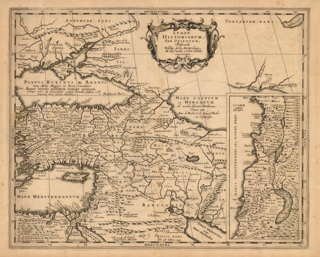
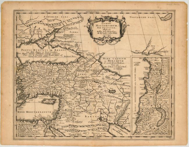
Subject: Near and Middle east
Period: 1684 (published)
Publication: Accuratissima Orbis Delineatio
Color: Black & White
Size:
18.7 x 15 inches
47.5 x 38.1 cm
Beautifully engraved map of the region from the eastern Mediterranean to the Persian Gulf based on the Ortelius/Vrients map of this title designed by Franciscus Haraeus. The map extends through Turkey and the Caucasus to include the region north of the Black Sea. Details include the pyramids in Egypt, the route of Abraham from Ur to Sichem, and the wandering of the Children of Israel. A large inset map of the Holy Land is shown at the right. This map was engraved by Kaerius, whose signature appears above the left hand bottom border, for Georg Horn's classical atlas, published by Jansson-Waesberg.
References: Laor #323; Phillips (A) #5614-58.
Condition: B
Crisp impression. Overall toning and some brittle edges with some chipping. A couple short tears, most marginal, one just into map at the bottom. All the tears have been repaired with archival tape on the verso.