Subject: France
Period: 1716 (published)
Publication: Grosser Atlas
Color: Hand Color
Size:
22.4 x 18.8 inches
56.9 x 47.8 cm
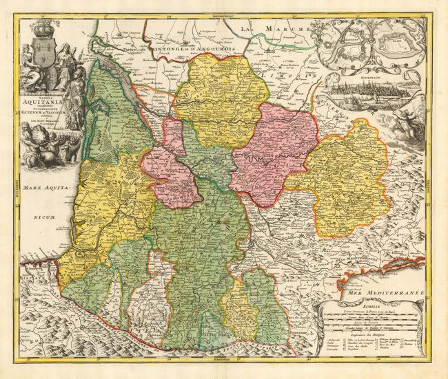
Large decorative map of southeastern France. Fully engraved with mountains, forests, roads and cities. Inset surrounded in a decorative border with fortification plans of Bayonne and Blaye, and a fine vignette view of the city of Bordeaux. Good detail of the Pyrenees and a highly detailed depiction of the Canal du Midi. This fantastic undertaking connected the Atlantic (via the Garonne River) with the Mediterranean in one of the most incredible engineering feats of the 17th century. It was opened in 1681 after fourteen years of construction under the direction of Pierre Paul Riquet. Further embellished with a large, uncolored title cartouche containing figures of a soldier, a queen, a maiden, Neptune, the royal crest, and a garland draped scale of miles. A near fine and very lovely example of this map.
References:
Condition: A
Very crisp impression with strong, original full color. Cartouche uncolored as issued. Two small, minor stains in map along centerfold, else fine.