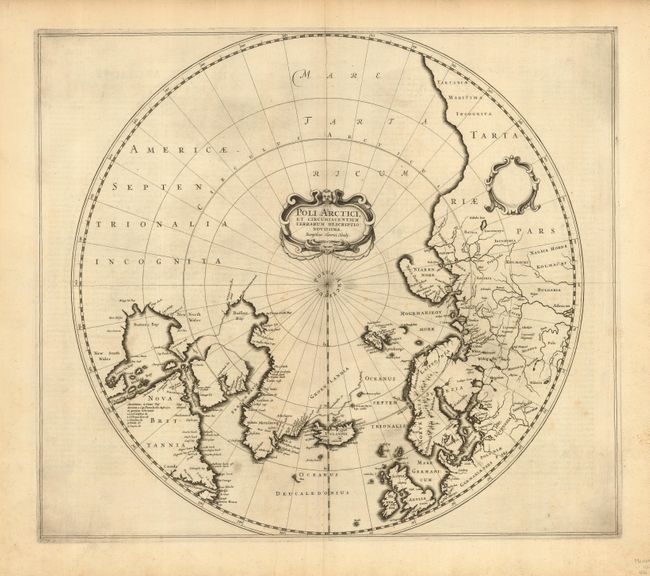
Subject: North Pole
Period: 1636 (published)
Publication:
Color: Black & White
Size:
19.5 x 17 inches
49.5 x 43.2 cm
A very early edition of Hondius' important map of the polar region that replaced Mercator's polar map and incorporated much of the knowledge gained by the English in their search for a Northwest Passage to Asia. The North American cartography is based on Henry Briggs depiction of Hudson Bay. Numerous discoveries are shown including those of Frobisher, Davis, Baffin, Hudson, Button, Foxe and James. There are several Dutch names in Labrador, many appearing for the first time on this map. English text on the verso describes the peoples, animals (including unicorns) and explorations of the North Pole. First state of this map without the whaling scenes.
References: Burden #246; Kershaw #97.
Condition: B
Extra sharp impression on strong paper with just a tiny amount of light foxing.