Subject: North Pole
Period: 1600 (circa)
Publication: Geographisch Handtbuch
Color: Black & White
Size:
10.8 x 8.3 inches
27.4 x 21.1 cm
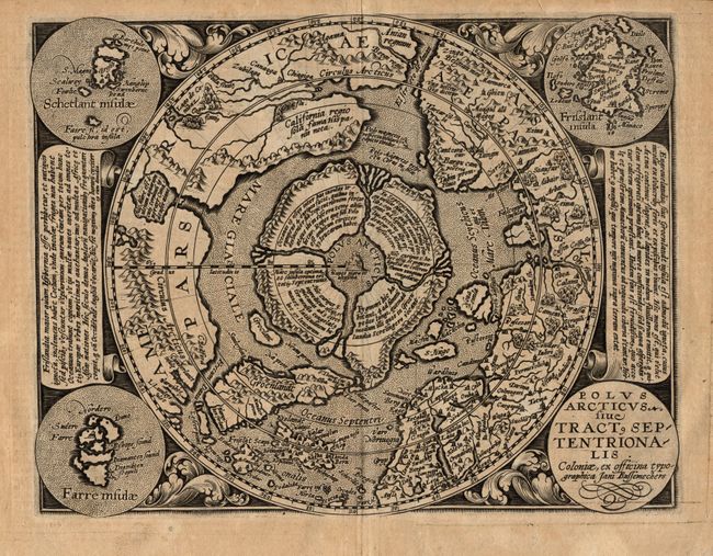
This scarce map is a reduced version of Mercator's landmark map of the Arctic from 1595. The hemisphere is surrounded by a floral design with four roundels in each corner. These contain the title, the Faeroe Isles, the Shetland Isles, and the mythical island of Frisland. The North Pole is shown according to legend as a large rock in a giant whirlpool and surrounded by four islands that are separated by rivers. The magnetic north is depicted as a separate island rock just outside the polar mass. In North America is an very early reference to California (California regio, sola fama Hispanis nota), curiously shown north of the El streto de Anian. The map depicts the attempts of Frobisher and Davis to locate the northern passages to Asia. Latin text on verso. Engraved by Johannes Bussemacher.
References: Burden #134.
Condition: A
Dark, crisp impression with even toning overall. There are some hinge remnants on the verso.