Subject: Finland
Period: 1771 (dated)
Publication:
Color: Black & White
Size:
12.8 x 17 inches
32.5 x 43.2 cm
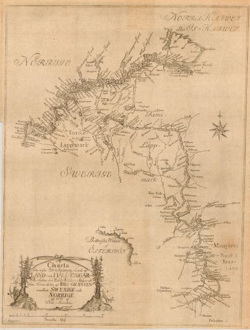
A rare issue that was likely published in Marelius' 'Various Charts of Sweden' that was in publication between 1773 and 1779. This map, dated 1771, was strongly engraved by C. Berquist. It shows good detail throughout Lapland with mountains and watershed delineated. Decorative title cartouche features engravings of a Laplander with bow and arrow and a reindeer. Further embellished with a compass rose and distance scale using the 'Swenska Myl.' The map shows a small portion of the coast in the southwest to include today's Tornio. The map extends to the northeast to detail the interior mountains, watershed, and place names as it eventually follows the flow of the Inarijoki - Tenokoki River to the sea at the Tanafjorden. A rarely seen issue.
References:
Condition: B
Issued folding, now flat. Good impression on thick hand laid paper. Some areas of light toning.