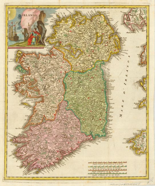
Subject: Ireland
Period: 1743 (published)
Publication: Lo Stato Presente... E Dell’Irlanda
Color: Hand Color
Size:
12.5 x 15 inches
31.8 x 38.1 cm
Beautifully engraved map of Ireland, finely detailed with much topography and political information. The map shows the four provinces of Ireland, Leinster, Munster, Connacht and Ultster, here called Lagenia, Momoniae, Connacia and Ultonia. This map was made just after one of the first Great Famines (1740-41) in Ireland, which is not as well known as the Famine of 1847-49. The year 1741, during which the famine was at its worst and mortality was at its highest was known commonly as the 'year of the slaughter'. This period of famine was due to a great cold snap that affected all of Europe, but Ireland was hit the worst.
References:
Condition: A
Issued folding, now pressed. Lovely old color.