Catalog Archive
Auction 118, Lot 551

"A Mapp of the Parish of St. Margarets Westminster, taken from the last Survey, with Corrections.", Strype, John
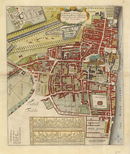
Subject: England

Period: 1720 (circa)

Publication: Stow's Survey of London

Color: Hand Color

Size:
11.6 x 13.8 inches
29.5 x 35.1 cm
Download High Resolution Image
(or just click on image to launch the Zoom viewer)

This is the first detailed ward map of Westminster. St. James's Park and Buckingham House appear in the top left corner. St. Peter's Cathedral is shown in profile. The plans for this reissue of John Stow's Survey of London were probably originally engraved by Richard Blome just before his death in 1705. However, the edition took until 1720 to achieve publication and the plans required revision due to the city's rapid growth. Blome was credited in the preface but his name was erased from the plates, and can barely be seen in this cartouche.

References:

Condition: B

Centerfold reinforced with paper on verso with slight toning on fold. Some pencil marking in blank margins.

Estimate: $275 - $350

Sold for: $350

Closed on 3/6/2007

Archived