Subject: England
Period: 1675 (circa)
Publication: Britannia
Color: Hand Color
Size:
17 x 12.2 inches
43.2 x 31 cm
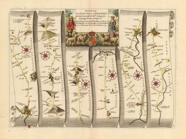
John Ogilby's 'Britannia' was published between 1675 and 1698. It is a landmark in the mapping of England and Wales. Its unique format constituted the first national road-atlas of any country in Western Europe. It was composed of maps of seventy-three major roads and cross-roads, presented in a continuous strip-form, on a uniform scale of one inch to a mile. Each beautiful map includes wonderful detail of the countryside with each strip containing a large compass rose to indicate changes in direction.
This map features the road from Glocester through Winchcombe, Campden, Stratford upon Avon, and Warwick to Coventry. The cartouche includes a pastoral scene of a shepherd and shepherdess and their flock of sheep. Plate number 70 at lower right.
References:
Condition: A
Printed on quality hand-laid paper with a good impression and wide original margins. Small rust spot at bottom neatline, else fine. Remnants of framer's hinges on verso.