Subject: Britain
Period: 1635 (circa)
Publication: Theatrum Orbis Terrarum sive Atlas Novus
Color: Hand Color
Size:
19.5 x 15 inches
49.5 x 38.1 cm
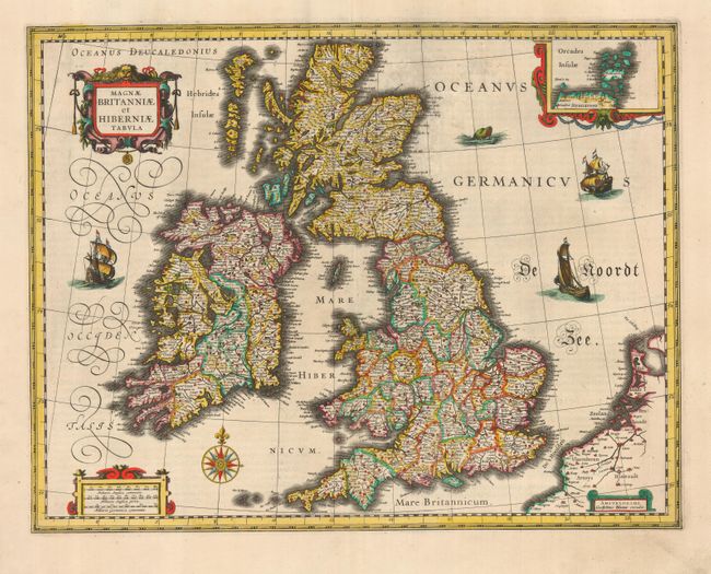
This handsome map of the British Isles is believed to be printed from the revised plate of Hondius' carte-a-figures map of 1630. It is filled with minutely engraved topographical and political detail of England, Wales, Ireland and Scotland, and is inset with a small map of the Orkney Islands. The map appeared in many of the Blaeu atlases between 1634 and 1672 and was included in all editions of the Blaeu atlas of England and Wales from 1645 onwards. It is decorated with a lovely compass rose, and a decorative scale of miles and title cartouche. Three delicately engraved ships and a large sea monster complete the composition. French text on verso.
References:
Condition: A
Light surface soil, else fine with a sharp impression.