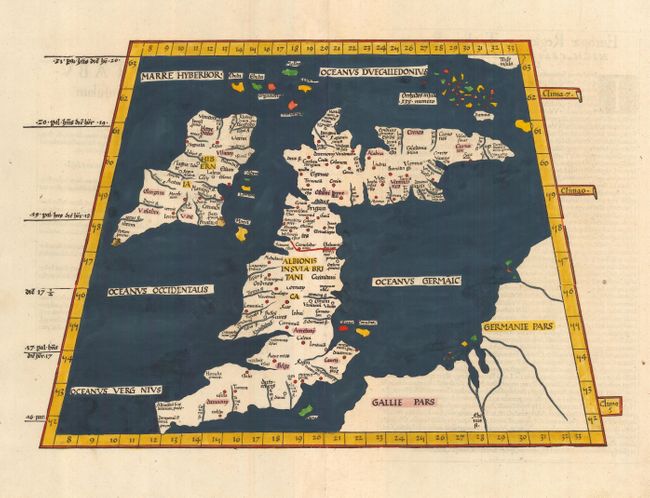
Subject: Britain
Period: 1541 (published)
Publication: Claudii Ptolemaei Alexandrini…
Color: Hand Color
Size:
16.3 x 11.6 inches
41.4 x 29.5 cm
This superb Ptolemaic map of the British Isles is presented in a trapezoidal projection with climates and ancient parallels inserted in the side borders. The geographical data used by Ptolemy was collected in the second century A.D., when Britain lay at the extremity of the known world. Thus the representation is distorted with Scotland shown in a distinctive east-west orientation and Ireland located too far north. The principal cities, tribal regions and rivers are located. This map is from the same woodblock used for the 1535 edition with revised Latin text on verso. It was printed by Gaspar Treschsel in Vienne, and is sometimes called the Lugduni-Vienne edition.
References: Karrow #28/2; Mickwitz & Miekkavaara #211-1; Shirley (MCC-90) #30.
Condition: A+
Bit of light soil in wide original margins, overall very fine.