Subject: Bermuda
Period: 1631 (published)
Publication:
Color: Hand Color
Size:
20.5 x 15.8 inches
52.1 x 40.1 cm
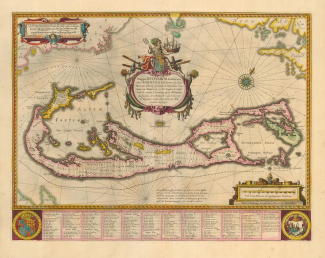
This magnificent map is based on the famous survey by John Norwood of the Bermuda Company in 1618. The map shows the division into the original eight tribes and shows the various landowners, with their names in a table below the map. The beautiful title cartouche features Neptune astride the Royal Arms, holding a fine ship. Further adorned with scale cartouches, coats of arms and a compass rose. The map uses a unique device to show Bermuda's correct proportion and position in the North Atlantic by superimposing this map over a smaller scale map of the Atlantic with the coastlines of Britain, North America and Hispanola, with a tiny island of Bermuda appearing just beneath the title cartouche. French text on verso.
References: Goss (Blaeu) p. 166; Palmer (MCC-19) #7; Van der Krogt (Atlantes) #9660:2.
Condition: A
Excellent impression printed on strong paper with lovely original color.