Subject: Atlantic Ocean
Period: 1668 (circa)
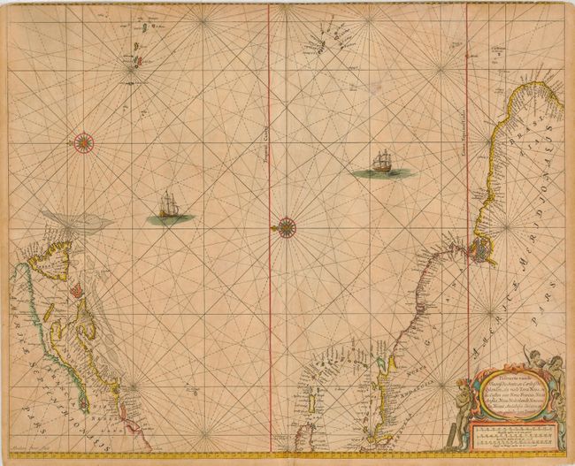
Publication: De Zee Atlas ofte Water Weereld…
Color: Hand Color
Size:
21.3 x 17.5 inches
54.1 x 44.5 cm
This scarce sea chart covers the central Atlantic and extends to include the Maritime Provinces, Antilles and the northwest coast of South America over to the Azores, Cape Verde, Madeira and the Canary Islands. While covering the same area as Theunis Jacobsz' chart of circa 1650, Goos based his map on the cartography of Joannes van Loon and Hendrick Doncker. This is the second state of the plate with extensive revisions to the coastline of North America, with Cape Cod and the St. Lawrence River moved further west. In this state the Atlantic islands are moved further east, and the Brazilian coastline is extended eastwards. The engraver's signature, Abraham Deur, appears at lower left. The ocean is decorated with rhumb lines, compass roses, and sailing ships. Native figures adorn the decorative cartouche with three distance scales.
References: Burden #390.
Condition: C
Printed on double thick paper, as was common with many sea charts. Original outline color, toned throughout. Top margin trimmed into border, apparently by a previous binder.