Subject: World
Period: 1775 (circa)
Publication: Le Petite Atlas Maritime
Color: Black & White
Size:
13.5 x 8.7 inches
34.3 x 22.1 cm
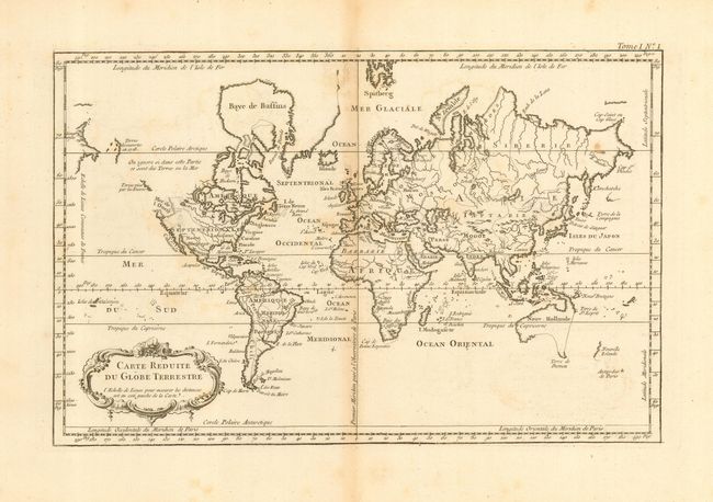
A boldly engraved copper plate chart of the world on Mercator's projection. North America is shown with a large Mer de l'Ouest with two outlets to the Pacific. The entire region above the Sea of the West is blank with no shoreline, keeping alive the faint hope for a Northwest Passage. A short span of isolated coastline approximately located in the Alexander Archipelago is called Terras viies par les Russes with a few islands to the northwest noted as discovered in 1748. Australia is labeled Nouvelle Hollande with Terre de Diemen linked to the mainland by dotted lines. New Zealand is in an early depiction with just one portion of the west coast shown. Rococo-style title cartouche and degreed borders.
References:
Condition: B
Good impression printed on thick hand laid paper with very wide margins. Toned along centerfold and some light scattered toning.