Subject: Gulf of Mexico and Caribbean
Period: 1747-52 (circa)
Publication: A Complete Atlas or Distinct View of the Known World
Color: Hand Color
Size:
16.5 x 13.5 inches
41.9 x 34.3 cm
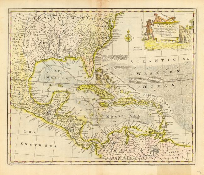
This is an attractive copper engraved map covering the southeastern United States, eastern Mexico, Central America and the West Indies. The map is derived from Popple's important map of the region. The British colonies are confined east of the Appalachians with France in control of Louisiana. Many early forts and Indian tribal territories are located. There are several interesting notations concerning the history of the region, e.g., "K. Charles II by Charter dated June 30th 1665 granted the E. of Caredon, D. of Albermarle, &c. the Province of Carolina, extending Southward to the 20 Deg. of N. Latitude so that Fort St. Augustin as well as Georgia falls within these limits." Trade winds and sea routes are marked throughout, including the course of the Spanish gold fleet from Old Spain and the return trip from Cartagena and Vera Cruz. The title cartouche is adorned with Native Americans and an incongruous lion (likely representing the British colonies).
References: Sellers & Van Ee #1682.
Condition: B
Good impression. Toned on centerfold, with some fraying at the top of the map, including a repaired tear just into map. Bottom right margin discolored from old adhesive label, not affecting map. Hinge remnants on verso.