Catalog Archive
Auction 118, Lot 444

"Insulae Americanae in Oceano Septentrionali cum Terris adiacentibus", Jansson, Jan

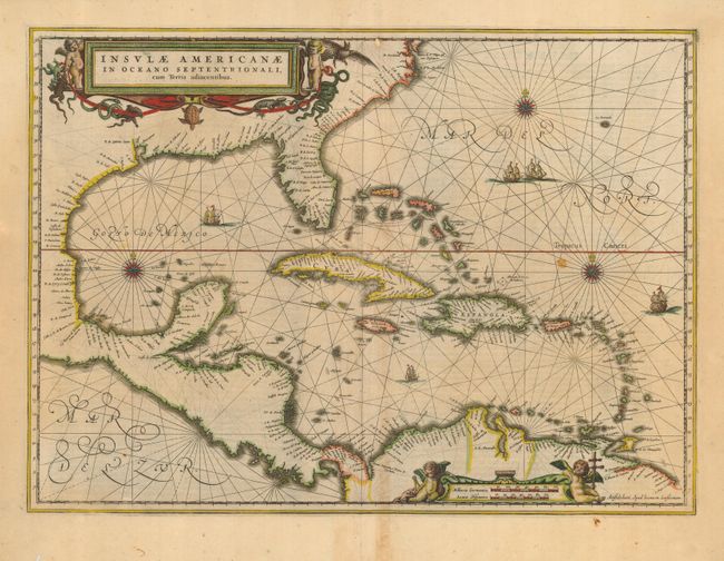
Subject: Gulf of Mexico and Caribbean

Period: 1636 (circa)

Publication:

Color: Hand Color

Size:
20.5 x 14.8 inches
52.1 x 37.6 cm
Download High Resolution Image
(or just click on image to launch the Zoom viewer)

Beautiful copper engraved map of the Caribbean and the eastern coast of North America from the Chesapeake through the Gulf of Mexico, with Mexico, Central America and the northern coast of South America. Cartographically drawn on the extremely rare chart of Hessel Gerritsz 1631. This is the first state of this map, Dutch text on verso. Lovely title and scale of miles cartouches, rhumb lines, compass roses and sailing ships make this a very attractive map.

References: Burden #248.

Condition: B

Minor toning and a couple of stains in map and margin. Small bit of loss in top border at center.

Estimate: $1,500 - $1,800

Sold for: $1,100

Closed on 3/6/2007

Archived