Subject: Texas
Period: 1865 (published)
Publication: New Illustrated Family Atlas
Color: Hand Color
Size:
21.8 x 15.8 inches
55.4 x 40.1 cm
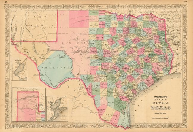
Large, handsome map with county development mostly in eastern Texas and only the three large counties of El Paso, Presidio, and Bexar in the west. The panhandle, noted as the Staked Plains (Elevated Table Land, without Wood or Water), includes a large section that is unorganized. Nice depiction of the wagon roads and several completed railroads. Insets include a Plan of Sabine Lake, Plan of the Northern part of Texas, and Plan of Galveston Bay. Decorative latticework border. Text on verso.
References:
Condition: B
Evenly toned throughout map, with a couple of minor foxing spots. Several short, marginal tears, not affecting map, repaired with archival tape.