Subject: Texas
Period: 1846-50 (published)
Publication: Sen. Doc 32, 1st Sess. 31st Congress
Color: Black & White
Size:
17.2 x 11.6 inches
43.7 x 29.5 cm
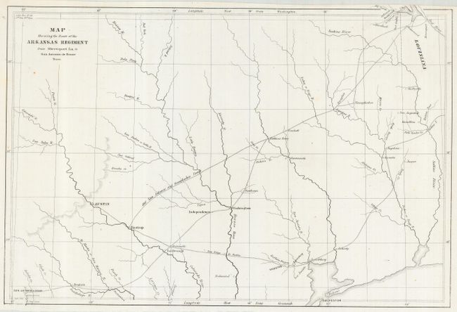
Uncommon map covering east-central Texas from Shreveport on the Red River to San Antonio. The Old San Antonio and Nacogdoches Road is prominently shown. This fascinating map locates several very early settlements including Douglas, Nacogdoches, Crockett, Robbins' Ferry, Washington, Independence, Bastrop, Houston, Liberty, Austin, Saguin, and, of course San Antonio de Bexar. Good detail of the watershed delineates the flow of the Guadalupe, San Marcos, Colorado, Brazos and Sabine Rivers. Also locates several tributaries including the San Saba, Pecan, San Andres, Bosque, and Argentina Rivers, and the creeks of Brushy, Palo Pinto, Peach, Cibolo, Saloda, Lavaca, Village, Alabama, and Bidais. This map was among the maps submitted to Congress to illuminate the U.S. Army's first explorations in Texas, and accompanied Capt. G.W. Hughes "Memoir descriptive of the March of a Division of the US Army under the command of BGen. J.E. Wool from San Antonio in Texas to Saltillo in Mexico." A very nice example of this early sheet.
References:
Condition: A
Issued folding, now pressed. This is a clean, bright copy with fine impression. Close margins, as issued. When held to a strong light scattered very tiny holes are visible that appear to be paper-making flaws rather than any physical damage.