Subject: Texas
Period: 1840 (dated)
Publication: Sen. Ex. Doc. 199, 27th Cong., 2nd Sess.
Color: Black & White
Size:
17.8 x 22 inches
45.2 x 55.9 cm
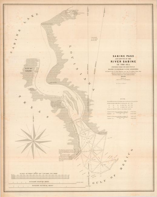
This map is among the most important government maps during the period of Texas independence. It was produced for the report of the Joint United States - Texas Boundary Commission, which for the first time depicted the eastern border of Texas. This map covers the section from Sabine Lake to the Gulf of Mexico and shows soundings, Sabine City and the U.S. Customs House. It was surveyed under the direction of Major J.D. Graham U.S. Topographical Engineers by Lt. T.J. Lee of the U.S. Topographical Engineers and Capt. P.J. Pillans of the Texan Army, and drawn by Lt. Lee. Engraved by W.J. Stone and published in 1842. It is a rare, and important part of Texas' cartographic history.
References: Day #952E; Martin & Martin, p. 36.
Condition: B
Issued folding, now flattened. Light scattered foxing and a couple of short splits on folds.