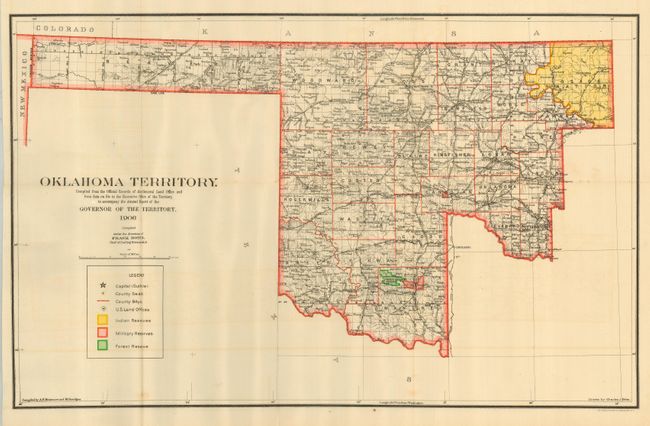
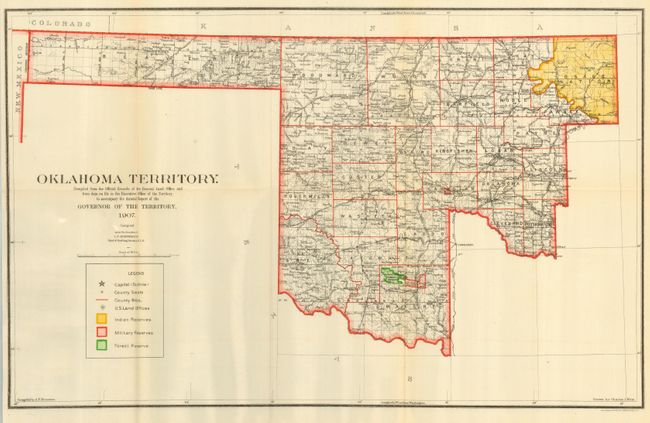
Subject: Oklahoma
Period: 1906-07 (dated)
Publication:
Color: Printed Color
Size:
22 x 13.8 inches
55.9 x 35.1 cm
Great pair of colorful maps that detail the development and changes in the two years before statehood. Both were drawn by Charles J. Helm. They were compiled under the direction of Frank Bond (1906) and I.P. Berthrong (1907), Chiefs of Drafting. They were prepared from the "official records of the General Land Office and from other data on file in the Executive Office of the Territory, to accompany the Annual Report of the Governor…" Both maps are keyed to a legend located at lower left. They show the counties, Indian Reservations, Military Reservations, Forest Reserves, many place names, waterways, and railroads. Gutherie is shown as the capital for both years. Oklahoma Territory was created in 1890. After the addition of the Cherokee Outlet (1893) and Green County (1896) it had the configuration seen here until Oklahoma, absorbing the Indian Territory, was admitted as a state in 1907. Thus, the 1907 issue is the last map of Oklahoma as a territory. Great pair of maps whose study may uncover a small difference between them not discovered by this cataloger.
References:
Condition: A
Both folding as issued. Former with a little light offsetting in blank areas, latter with very light toning at one folds. Both still very good with lovely coloring on very sound paper.