Subject: Oklahoma
Period: 1896 (dated)
Publication: Sen. Doc. 169, 54th Cong., 1st Sess.
Color: Printed Color
Size:
28.5 x 26 inches
72.4 x 66 cm
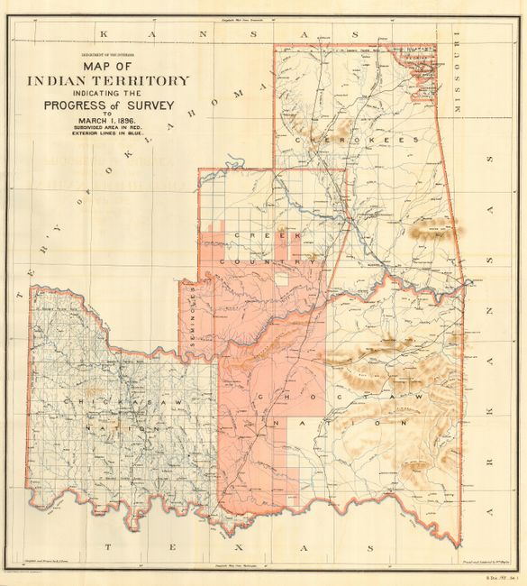
This rarely seen Senate version exactly matches the configuration of the rare State of Sequoyah the Indian Nations attempted to create in 1905 in an effort to thwart the expansive tendencies of the United States. The regions of the Chickasaw, Choctaw, Creek, Seminole, Cherokee, and several other Indian tribes are named. The Territory of Okalahoma hovers ominously in the northwest. Subdivided areas are shown in red and exterior border lines are in blue. This historical map was compiled and drawn by R.P. Lowe, traced and lettered by Wm. Naylor. Lithography by the Norris Peters Company. A most desirable map for which, in this Senate format, we find no prior sales records. The same map was published two months earlier as House Document #169 with the slightly different title "Progress of Survey and Subdivision Indian Territory." A scarce issue.
References:
Condition: A
Folding, as issued. With lovely coloring, crisp image and full margins. Near fine with just a little light offsetting visible in blank areas.