Subject: Oklahoma
Period: 1872-80 (dated)
Publication:
Color: Hand Color
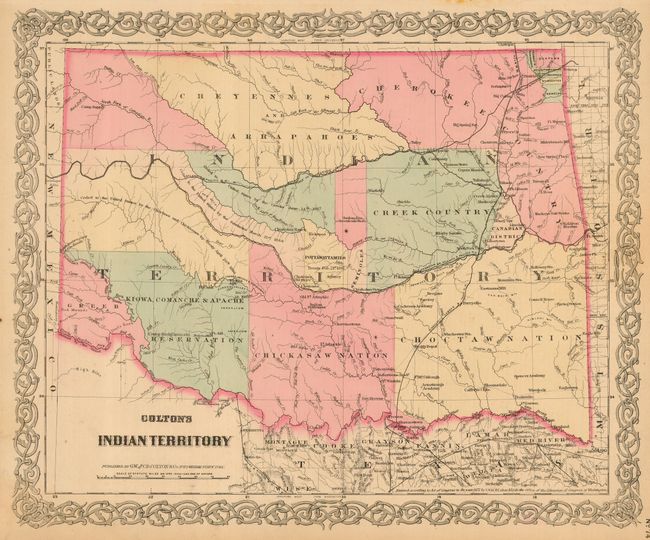
The first map is Colton's "Indian Territory," 1872, New York, 15.5" x 12.8". The map does not include the panhandle, which are Public Lands by this time. Each Indian region is boldly engraved and delineated through hand coloring. The Nations of the Kiowa, Comanche & Apache, Chickasaw, Choctaw, Creek, Cherokee, Cheyenne and the Arapaho, plus several others are named. Filled with information, it includes place names, forts, railroads, and notes on land transfers. Colton's ornate scroll border surrounds the map. This is a later edition published by G.W. & C.B. Colton.
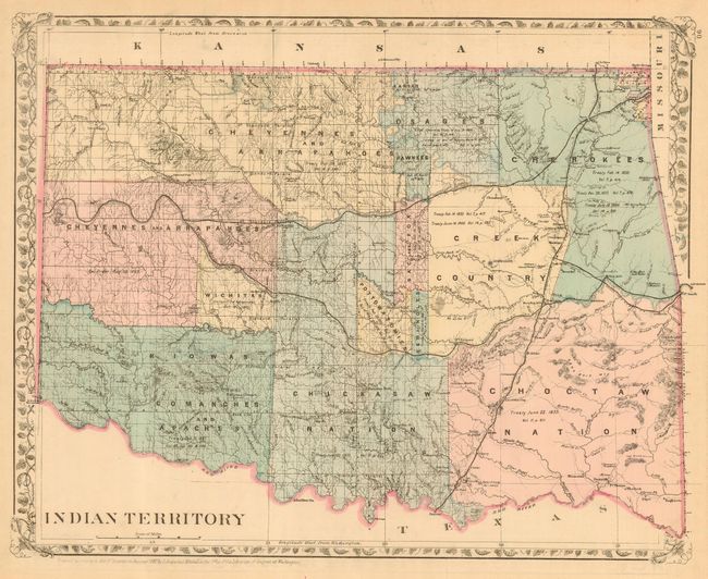
The second map was published in Philadelphia by Samuel A. Mitchell in 1880. Titled "Indian Territory," the map is delicately colored to delineate the numerous Indian Nations and also does not include the Public Lands of the panhandle. It is filled with details of watershed, towns and villages, railroads, forts, military reservations, etc. The land holdings of the Indian Tribes are shown and text describes the treaty instrument and date of each region. Published by William M. Bradley & Bros. An equally fine map of Colorado is on the verso.
References:
Condition: A
Both with original hand coloring. The former with a little marginal toning. The latter has a short marginal tear at top that just touches the border.