Subject: Oklahoma
Period: 1858 (dated)
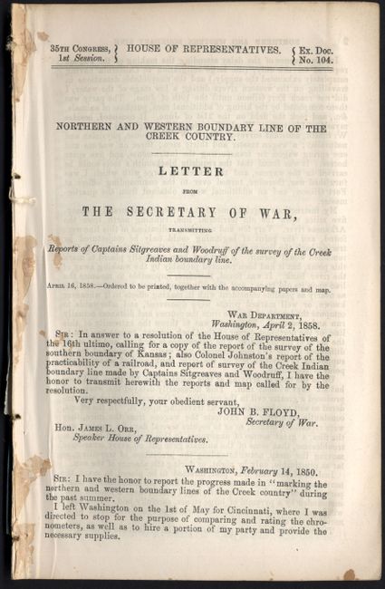
Publication: HR Ex. Doc No. 104, 35th Cong., 1st Sess.
Color: Black & White
Size:
36 x 24 inches
91.4 x 61 cm
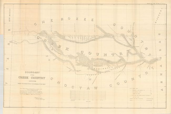
The area covered by Sitgreaves' large map lies in the watershed of the Canadian River and Red Fork of the Arkansas River in Indian Territory. It extends from Fort Smith to the border with New Mexico Territory. The lands of the Cherokee, Creek, Seminole and Choctaw Indians are located. The map locates numerous forts, including Smith, Coffee, Gibson and Old Fort Holmes, and their connecting wagon roads. Talasee is shown at the site of Tulsa. There are other interesting place names such as Post Oak and Black Jack. This map was issued with the "Northern and Western Boundary Line of the Creek Country" report by Sitgreaves and Lt. J.C. Woodruff. It is the only Creek Country map listed in the reference noted. Complete and still bound in its original 32 pp. Congressional report "Northern and Western Boundary Line of the Creek Country." The report's transmittal letter to the Secretary of War is dated 1850, but the report itself is dated April 2, 1858. An uncommon map complete with the seldom seen report.
References: Phillips (M) p.251.
Condition: A
The map is folding, as issued. A hint of offsetting or light toning, and a short tear at binding trim.