Subject: New York
Period: 1902 (dated)
Publication:
Color: Printed Color
Size:
16.4 x 57.3 inches
41.7 x 145.5 cm
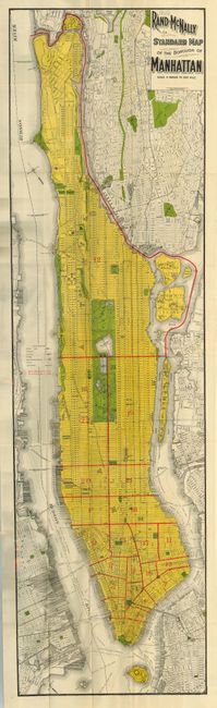
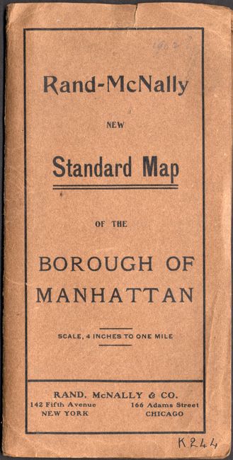
A remarkably bright and beautifully printed pocket map with lovely color. The map extends, on a scale of 4 inches to the mile, all the way north to Ship Canal and south to include Governor's Island. Very detailed with all streets named, elevated railroads shown, the Brooklyn Bridge, the Hudson River Tunnel and scores of ferry routes located. Also includes parts of surrounding towns and cities. Filled with numerous parks including a very detailed Central Park. A fine tourist oriented pocket map that folds into 4" x 8.5" paper covers titled "Rand-McNally New Standard Map of the Borough of Manhattan."
References:
Condition: A
Near fine example with bright color and crisp impression. One short marginal tear next to pastedown area. A few fold intersection splits, as always found on these large maps from this period. Cover is very good.