Subject: Michigan
Period: 1850 (dated)
Publication: Mitchell's New Universal Atlas
Color: Hand Color
Size:
10.3 x 13.3 inches
26.2 x 33.8 cm
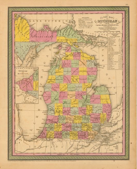
Lovely, early map of Michigan with county development throughout, but not much settlement shown above Saginaw, with the notable exception of the town and island of Mackinaw. The counties number only 64, as opposed to the 83 counties of today. Railroads are shown only in the extreme southern portion, highlighted in red and emanating in large part from Detroit. Ann Arbor is shown and named as Ann Arbour, with Ypsilanti and Dexter nearby. The left portion of the map is inset with the Western Part of Michigan. A table to the right gives the cities and distances along the steamboat routes from Detroit to Fort Gratiot and then continuing to Fort Howard. Fancy titling and decorative scroll borders.
References:
Condition: B
Light toning and a bit of minor foxing. Original hand color.